
Troy ZIP Code Coverage
The postal designations associated with Troy have different levels of confirmation. Official city-address material establishes that 48083, 48084, 48085, and 48098 occur on Troy addresses. For 48007 and 48099, the inspected sources did not verify in-city address coverage. The table preserves that difference. It does not turn broad postal labels into neighborhood boundaries, city limits, or a directory of people.
| ZIP | Areas Covered | Post Office | Notes |
|---|---|---|---|
| 48007 | Troy mailing designation appears in official postal and local lists | Exact current service area not verified | No in-city address coverage was verified; use USPS for each address |
| 48083 | Troy delivery addresses documented, generally southeast/east context | USPS delivery ZIP | Exact neighborhood boundary was not published in the inspected source |
| 48084 | Troy delivery and city-government addresses, generally central/west context | Address-specific USPS assignment | City and county records use situs and PIN, not ZIP alone |
| 48085 | Troy delivery addresses documented, generally north/east context | USPS delivery ZIP | Verify the address because exact edges were not published |
| 48098 | Troy delivery addresses documented in official city material | Historical delivery-change context | Some deliveries moved to 48085 in the 2001 postal realignment |
| 48099 | Troy post-office or special mailing designation | Troy facility ZIP | No in-city parcel coverage was verified; it is not a city-boundary proof |
A postal directory can narrow a postal question, but it cannot settle a legal boundary or identify every address in a city. The city’s Do Not Knock material supplied actual Troy examples in 48083, 48084, 48085, and 48098. USPS remains the authority for a particular address, including any address that appears to fall near a postal edge.
Troy ZIP Codes and City Limits
A Troy postal-routing label is not a municipal jurisdiction. Census ZIP Code Tabulation Areas, or ZCTAs, are another layer: they approximate ZIP geography for statistics but are not USPS delivery areas or legal city boundaries. The Census data page lists ZCTAs 48073, 48083, 48084, and 48085 in Troy-city context. That is useful population context, not a ruling on which addresses are inside the city.
The state’s approximate ZIP map labels Troy-area 48083, 48084, and 48085, while warning that its boundaries are approximate and are not Census ZCTAs. A parcel’s jurisdiction comes from the parcel and its local government record. USPS standardizes the mailing address. When those questions differ, use both sources rather than reversing a postal label into a city-limit decision.
Use USPS ZIP Code Fields
After the coverage table, use the USPS postal lookup with a complete address. It offers three distinct routes: By Address, By City and State, and Cities by ZIP. The address route is the best choice for testing one Troy mailing address. A result standardizes the address; USPS specifically warns that it does not confirm that a person or company is located there.
| USPS search route | Fields and use |
|---|---|
| By Address | Company optional; Street Address required; Apt/Suite/Other optional; City required; State required; ZIP optional; Urbanization Code may appear where relevant. |
| By City and State | City and State are required. This route returns postal information for the city and state combination. |
| Cities by ZIP | ZIP is required. Use it to see USPS city naming, then return to By Address for a particular location. |
| Find | Submits the selected route after the required fields are supplied. |
Visit the USPS lookup before moving a postal result into a Troy parcel search.
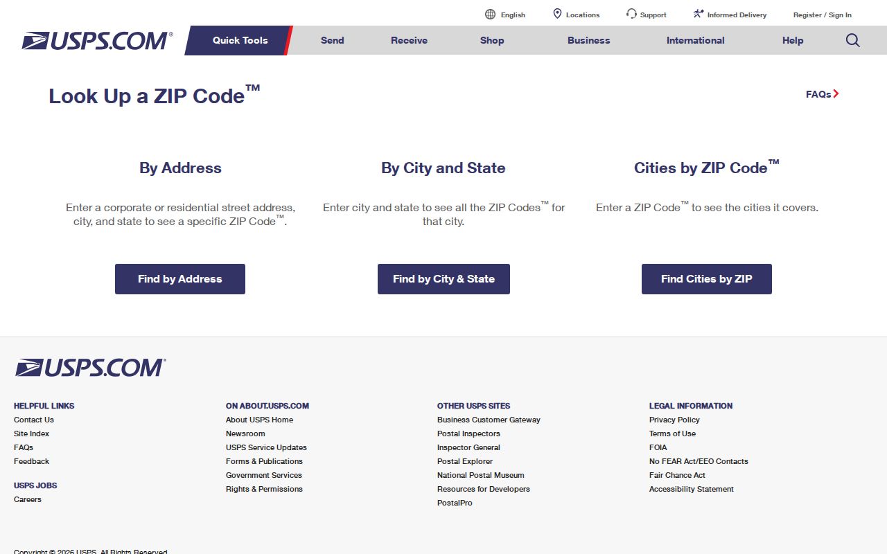
The field layout matters because it separates address validation from a name search. A ZIP result is a postal answer. It is not evidence about household membership, private delivery routes, or an address beyond the information USPS standardizes.
Find Troy Records by ZIP
No inspected Troy property portal offers a ZIP-wide browse. The Troy Parcel Information Center accepts an address or parcel ID. BS&A accepts Address, Name, and Parcel Number. Oakland Property Gateway accepts address or PIN patterns. The Michigan voter name lookup requires ZIP as an identity field with first name, last name, birth month, and birth year, but it does not provide a ZIP-wide voter list. That asymmetry means a ZIP check comes first, then the address or PIN becomes the next search key.
- Enter the complete Troy address into USPS By Address and record the standardized postal result.
- Use that address in the Troy Parcel Information Center, omitting street suffixes such as St, Dr, or Cir when the city form directs it.
- Carry the returned parcel identifier or address to the city or county property system for parcel-specific records.
- Use the Michigan voter lookup only for its stated name-and-identity process, not as a way to browse everyone in a ZIP.
- When the postal question becomes a street-level record question, continue with the Troy street directory workflow.
The requested Michigan QVF file is a separate process. Its geographic options include a state, county, jurisdiction, district, ward or precinct choice, rather than a ZIP-wide public web browse. Protected fields remain withheld. Postal routing and election geography should not be treated as interchangeable.
Troy Postal Search Limits
The local systems use different identifiers because they answer different questions. The city’s simple parcel form has no name field and no ZIP field. BS&A adds a Name field, but its inspected landing search did not expose a ZIP-specific filter. Oakland GIS uses address and PIN patterns, including partial and wildcard searches. USPS is therefore the postal validator, while parcel tools validate a physical parcel and the voter lookup validates a specific registration search.
| System | What the inspected route accepts | What it does not establish |
|---|---|---|
| Troy Parcel Information Center | Parcel ID or address | No ZIP filter and no simple owner-name field |
| BS&A Troy | Address, Name, or Parcel Number | No ZIP-specific filter exposed on the landing search |
| Oakland Property Gateway | Property address or PIN, including partial patterns | No ZIP filter shown in the inspected instructions |
| Michigan voter lookup | Name, birth month, birth year, and ZIP | Not a ZIP-wide voter browse and not a source for protected fields |
This comparison is useful precisely because the search boxes are not interchangeable. Start with the key the system actually accepts. A postal ZIP can help confirm an address, but it cannot replace a PIN, legal description, or the full identity fields required by a separate official system.
Troy Postal Facility Quirk
The USPS Troy post-office page identifies the office at 2844 Livernois Road, Troy, MI 48099-9998. Published hours are Monday through Friday, 8:00 a.m. to 7:00 p.m., and Saturday, 8:00 a.m. to 2:00 p.m.; the phone number is 248-619-1598. A nearby carrier annex is listed at 2351 Bellingham Drive, Troy, MI 48083. This facility pairing is a concrete reason not to treat either facility ZIP as the boundary of all Troy deliveries.
Open the USPS Troy location page for the postal-facility details.
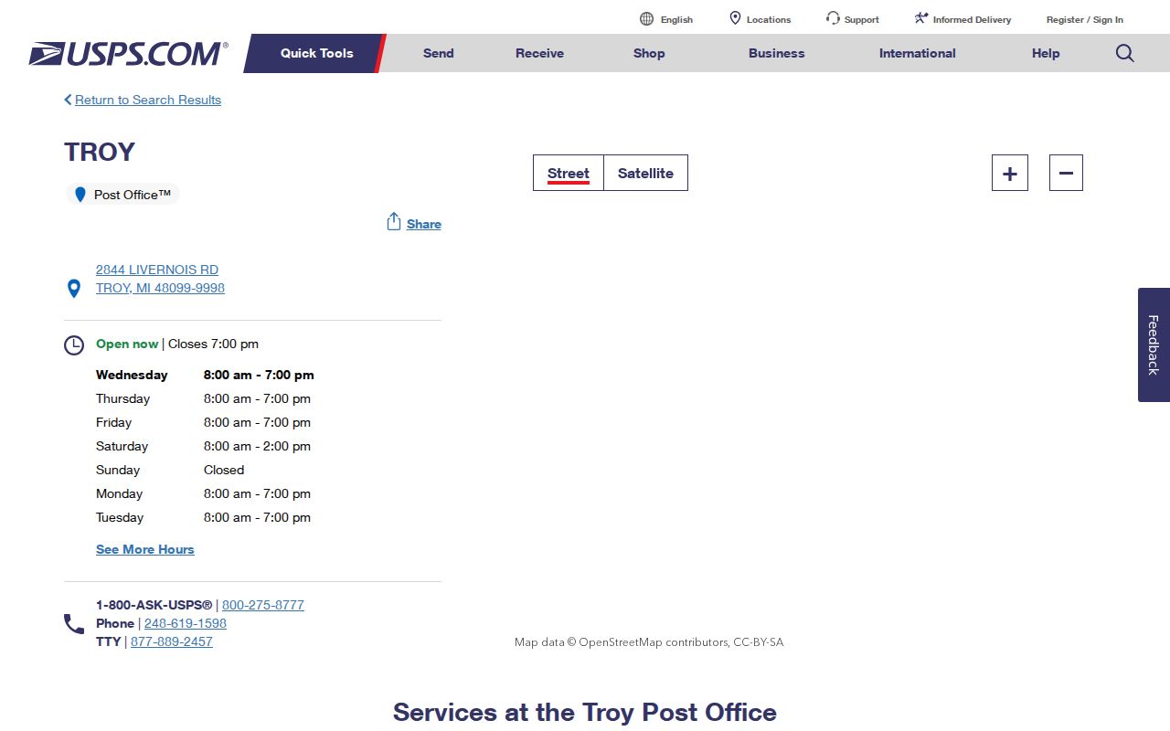
The facility designation is a service-location fact. Delivery ZIPs must still be tested by address. That is especially important for 48099, whose exact current in-city address coverage was not verified in the inspected sources.
Troy Postal Realignment
Postal history can explain an old label without deciding a current address. A USPS Postal Bulletin records a July 1, 2001 realignment in which some deliveries previously in 48098 shifted to 48085. A 2013 bulletin distinguishes Troy-area 48083 through 48085 and the separate 48007, 48098, and 48099 postal situations. Neither bulletin should be used as a current address finder, and the inspected official sources did not supply exact neighborhood names for every ZIP.
For an archival address, record the date printed on the original item, check the historical postal context, then run the current full address through USPS. If a legal or parcel question remains, test the situs address and parcel identifier with the city or county source. The point is comparison across dates, not a claim that an earlier postal assignment persists today.
Troy Postal Address Keys
Four labels often appear together but describe different things. Keeping them separate prevents a postal result from being overstated in a records search.
- ZIP code
- A USPS routing code used to standardize and direct mail. It is not a municipal-boundary or parcel-ownership label.
- ZIP+4
- An added four-digit delivery segment that further sorts mail within a ZIP code. It is not a city-jurisdiction field.
- PO-box ZIP
- A postal designation used for post-office-box service. It should not be assumed to show a physical Troy parcel.
- Unique ZIP
- A ZIP assigned to a single organization or delivery arrangement. No Troy unique-ZIP claim is made here without USPS confirmation.
- Carrier route
- A postal delivery sequence used for mail operations. It is not a public roster of addresses or people.
- Situs, mailing address, and PIN
- Situs is the physical parcel location; mailing address is tax-correspondence routing; the Oakland PIN is the parcel identity used for mapping and records.
When city and county records disagree with a mailing label, use the parcel’s jurisdiction and legal identifier for the property question, then retain the USPS-standardized address for the postal question. Utility records and private delivery lists are not public substitutes for those official keys.
Troy Postal Context
ZIP data needs an explicit date and geography label. Troy’s official 2020 Census population was 87,294, and QuickFacts lists a 2025 estimate of 88,733. The 2020-24 American Community Survey lists 33,372 households and 2.63 persons per household. These figures describe a citywide statistical context for stated years. They are not a live roster and cannot assign a person or household to a ZIP.
Troy’s square-mile grid and major intersections can help orient an address when a postal label is unclear, but the research did not locate an official complete quadrant formula or a street-renumbering chronology. Cross streets, a full USPS result, and the parcel PIN are safer bridges between a map, a historical record, and a current local record than an assumed ZIP boundary.