
Search a Troy Street
For a Troy street directory search, begin with one complete address, not a surname. The municipal parcel result establishes the parcel that physically sits on the road. Oakland mapping then helps identify the parcels beside it or farther along the same street. A deed supplies a dated ownership transaction, while voter and historical-directory paths can offer separate, limited evidence about residents. None of those sources is a substitute for another.
- Enter the address in the Troy Parcel Information Center and record the parcel ID, situs address, legal-description clues, and owner or customer label shown.
- Use the PIN or address in Oakland Property Gateway. Pan along the road and collect the PIN and parcel address for each parcel needed, instead of assuming a map result is a household.
- Search the same parcel or legal description in the Oakland Super Index. Note the purchase deed, its recording date, instrument number, grantor, and grantee.
- Use Michigan voter tools only through their permitted name or records-request channels. The public name lookup is not a street-browse list.
- For an earlier address snapshot, ask the Troy Public Library about a verified reverse or criss-cross directory, then match its year with a census or deed date.
That order keeps a Troy street search anchored to a parcel before names are compared. It also prevents an owner, a mailing contact, and a historical occupant from being treated as the same person.
Troy Parcel Search Fields
The Troy Parcel Information Center has one field, labeled “Parcel ID or Address.” It accepts either a local parcel format such as 88-20-21-401-001 or an address such as 500 W BIG BEAVER. Its small but important instruction is to leave off street suffixes such as St, Dr, and Cir. The form has no separate name field, so it is a parcel-first tool rather than a people index.
| Field or control | Use on a Troy street search | Format note |
|---|---|---|
| Parcel ID or Address | Find the local parcel | Enter a parcel ID or address without St, Dr, or Cir |
| Search | Submit the parcel query | One field and one button |
| BS&A Address | Find a municipal property record | Separate address route on the BS&A portal |
| BS&A Name | Compare a shown owner or customer label | Do not treat the label as proof of occupancy |
| BS&A Parcel Number | Return to the same property record | Use the displayed local format |
The Troy BS&A portal adds Address, Name, and Parcel Number searches, plus tax, permit, and inspection routes. Basic search is available, but detailed property information may use a $6.95 purchase route or a free claim route for up to five properties with an account. The visible 2785 W Maple Road sample was a business parcel, a concrete reminder that a customer label cannot be rewritten as a current resident.
Browse Troy Streets in GIS
The Oakland Property Gateway is the practical map step for a long street or a short road segment. It accepts a property address or PIN, requires at least five characters, and supports partial strings, partial PINs, comma-separated PINs, and percent wildcards. Examples documented by the county include 1200 S, 123 S V, 1401100, 1% Main, and 1% S% M. Those options help when an address was abbreviated differently in a deed.
The county’s Property Gateway is the source for this map-search view.
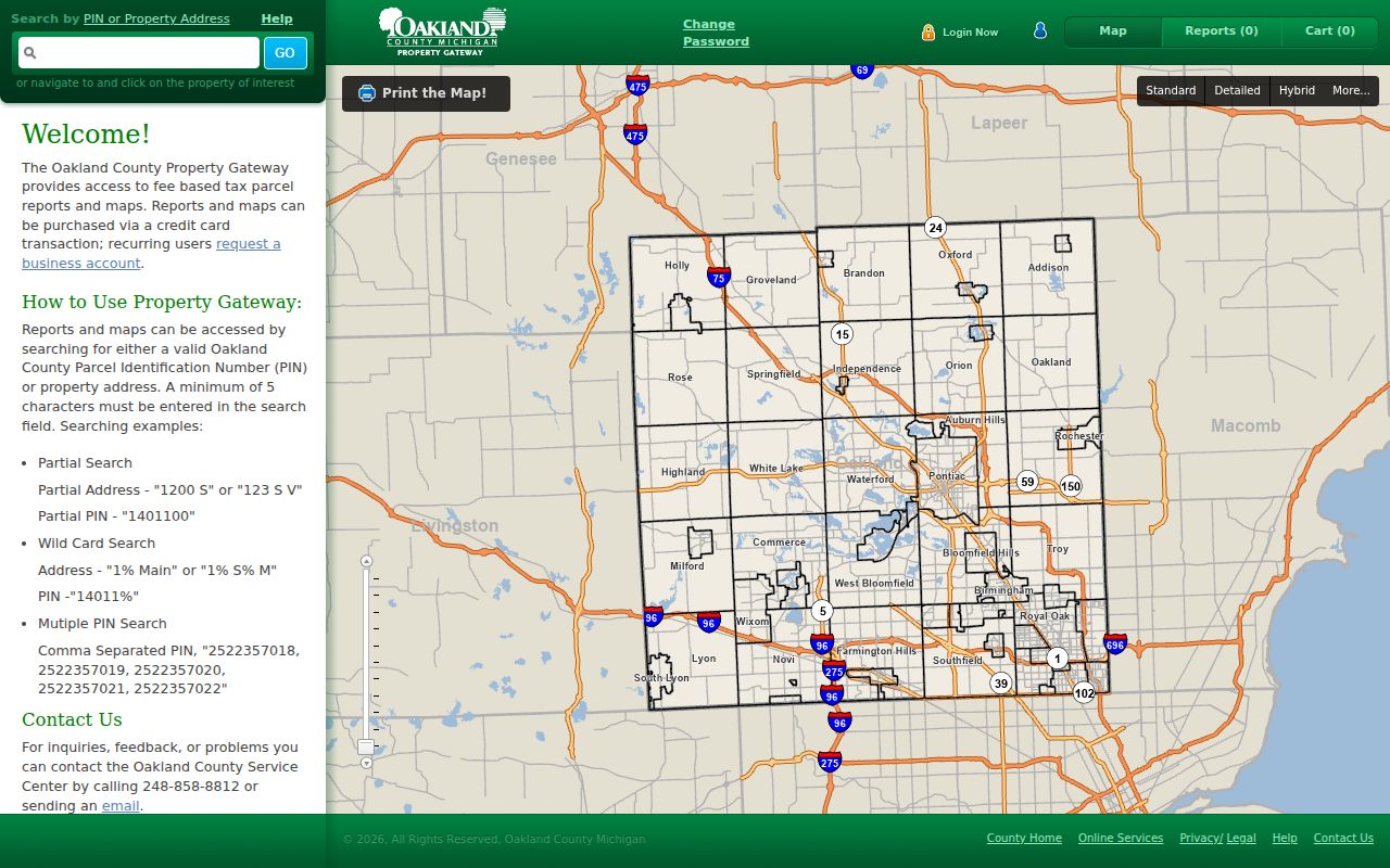
County mapping identifies tax-parcel, aerial, elevation, floodplain, zoning, master-plan, and school-district context. Reports and custom maps may have a charge through the county Service Center. The research did not verify an automated street export, a radius tool, or an exact live measure tool, so a street-by-street review should rely on map navigation and parcel clicks rather than an assumed bulk function.
Permits Mark Troy Address Changes
Building records can add dates and work descriptions that a deed does not show. Troy’s permit search is an address-oriented source for permit dates, type, work description, and applicant context. A permit can bracket construction or a later alteration, but it does not establish every person who occupied the address. The historical start date of the city portal was not identified in the research, so an absent result cannot rule out older work.
The Troy permits-issued search shows the city’s address, date, permit-type, and work-description route.
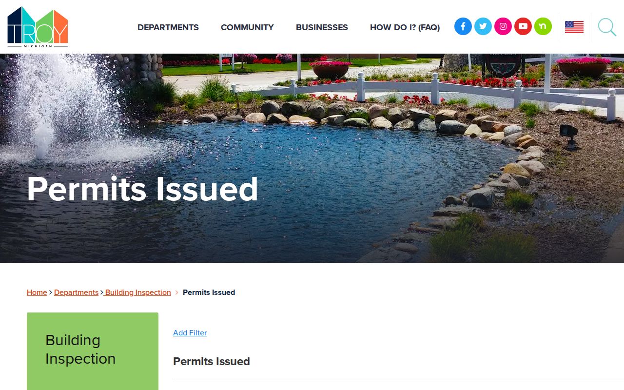
Citizen-request records are a different city-created layer. They may contain a location and city response, subject to retention and access rules, but they are not a roster. Keep the record type clear whenever an address turns up in more than one municipal system.
Records Attached to Troy Streets
An address can appear in several Troy and Oakland County systems, yet the meaning changes with the keeper. Parcel records identify land and tax administration. The deed index records instruments. Permits document work. Voter data has separate access controls. Historical directories are snapshots that still require a verified local volume. The PIN and legal description are the safest bridges between these systems.
| Address record | Custodian | Street-level evidence | Access route |
|---|---|---|---|
| Parcel and tax record | Troy assessor and BS&A | Parcel, owner/customer label, situs, mailing data, and tax context | City portal; some detail may require purchase or claim |
| Parcel map | Oakland County | PIN, tax parcel, address, and map-layer context | Free Property Gateway search; reports may charge |
| Recorded instruments | Oakland Clerk/Register of Deeds | Grantor, grantee, recording date, instrument, and legal description | Free index; images may be paid; older books in office |
| Building permits | City of Troy | Address, dates, work type, and applicant context | City permit portal; historic coverage not stated |
| Voter registration | Michigan Department of State | Registration information only through lawful channels | Name lookup or QVF request; protected fields withheld |
| Reverse directory | Library or history repository | Historical address-to-occupant snapshot | Exact Troy run must be confirmed locally |
Note: a parcel number connects property sources, but it does not convert an owner or mailing address into a list of everyone at the situs.
Deed Trails Along Troy Streets
The Oakland Super Index provides the recorded-document search for a Troy street directory investigation. A guest may search the index without an account. The guide lists “Search anything” for a name, address, or PIN, along with Grantor/Grantee, Recorded/File Date, Instrument Number, Document Type, Subdivision, Block, and Lot controls. Details or images may require individual payment, a cart purchase, or a subscription.
Start with the current parcel, then look for the purchase instrument by PIN, address, or legal description. The grantor is the party transferring an interest. The grantee is the party receiving it. To move backward, search the seller as an earlier grantee and compare the legal description before treating a result as the prior link. Recorded data is indexed after recording, but the computer index starts in January 1964. Older material remains a counter and manual-record question.
Current route change. Oakland County states that acreage-book searching moved to the free Super Index on July 1, 2026. Older manual records still require an office inquiry.
Lot Numbers Outlast Street Names
Street strings are useful, but not always durable. Troy planning material describes a square-mile grid, while the research did not locate a complete official numbering formula or a verified citywide renumbering chronology. When a modern address does not fit an older document, move to the parcel ID, legal description, subdivision, block, lot, or metes-and-bounds wording. The Oakland Tract Index is the county route for acreage, subdivision lots, condominium units, and metes-and-bounds research.
- Parcel or PIN
- A unique land identifier used to connect map and property records. Oakland describes the PIN as a ten-digit county identifier, though Troy displays its number with hyphens.
- Situs address
- The physical location of the parcel. It differs from a mailing address, which is used for tax correspondence.
- Plat
- A recorded map that lays out a subdivision. It helps connect a street address to a lot and block.
- Criss-cross directory
- A reverse directory arranged by street and house number, used to find a historical address entry before checking its alphabetical listing.
The Tract Index computer records cover January 1964 to the present. The office retains older records into the 1800s, subject to retention and manual-search limits. Its staff can be contacted for name-index work in person or by mail, and the county says it does not fax or search other counties.
Voter Records Along a Street
Michigan’s public voter lookup confirms an individual through first name, last name, birth month, birth year, and ZIP, or an alternate driver-license-number route. It is not an address browser. A streetwide Troy request cannot honestly be described as a public web search that returns every voter on a road.
The official QVF request form provides a lawful records-request path with geographic choices that include a jurisdiction and ward or precinct. Returned public fields may include name, residential or mailing address where available, year of birth, registration date, status, voter ID, and requested voter history. Full birth date, driver-license or ID number, phone, email, signature, last four Social Security digits, and protected information are withheld. The form offers pickup, FTP, or mail, not ordinary email, and directs requests to MDOS FOIA in Lansing.
Old Troy Streets by Address
For former occupants, ask the Troy Public Library catalog about Troy city directory, Oakland County directory, reverse directory, criss cross, telephone directory, Polk, obituary, yearbook, and newspaper terms. Exact Troy directory publishers, year runs, shelf numbers, and digitization status were not verified in the source set. A library or historical-society confirmation is therefore part of the research, not a formality.
Once a local reverse volume is confirmed, read the street alphabetically, find the house number, and then read the matching alphabetical entry for spouse, telephone, or business notation when printed. Pair the directory year with the closest released federal census. The National Archives makes census schedules from 1790 through 1950 available under the 72-year rule, but Troy Township or city geography must be checked for the date in question.
Troy Grid and Delivery ZIPs
Cross streets can orient a Troy address within the city’s grid, but they are not proof of an association boundary or a household. The City’s planning material identifies nodes such as Crooks/Wattles and Livernois/Square Lake as planning geographies. Use the parcel jurisdiction, PIN, and legal description for records work.
Postal information is a separate layer. Official city-address examples document 48083, 48084, 48085, and 48098, while 48007 and 48099 need an address-level USPS check. The Troy post office uses 48099-9998 and the nearby carrier annex uses 48083. That facility difference is a useful local quirk, not a parcel boundary. USPS can standardize an address, but it does not confirm that a person is there.
Limits of Troy Street Searches
A Troy street directory can identify public property records and dated address evidence. It cannot provide every renter, household member, utility customer, delivery recipient, protected voter, or person omitted from a deed, permit, or directory. A same-as-situs mailing address and an owner-occupancy indicator are clues used in property administration, not proof that someone is presently at the address.
Michigan’s Address Confidentiality Program gives eligible participants a designated address and withholding protections. Do not attempt to reverse a protected location through parcels, voter information, or public requests. Driver information also has separate restrictions under the federal Driver’s Privacy Protection Act and Michigan law. Scanned records should never be republished with sensitive personal fields.
Lawful use. Use Troy address records for personal research, family history, property questions, and civic curiosity. Public access never permits stalking, harassment, intimidation, or attempts to expose a protected location.